Keihin Electric Railways opened rokugo-bashi station-Omori station interval February 1, 1901.
It opens between Yahata and Shinagawa on May 8, 1904. (Correspond to Omori-kaigan-of present north Shinagawa. )
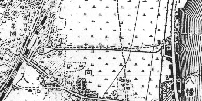
"Yahata" is changed into "Coast" before and after this Shinagawa extension (about 1904-05 and date uncertainty. )Moreover, after extending Shinagawa, the railway track in the Omori district has renewed the divergence from rokugo district to the divergence from the Shinagawa person. The map shows the state at the time of this in the illustration of the ordnance survey assumed to be a measurement in 1906.
"Omori station" station had the loop-line that touched a present JR Omori Station east exit, and set up the garage in this loop-line. It is exactly thought to be this arrangement of loop-line + garage that the purpose of the Omori extension is in the conserve line report, and can meet the wave motion demand of worshipper for Kawasaki-Daishi and Anamori-inari flexibly.
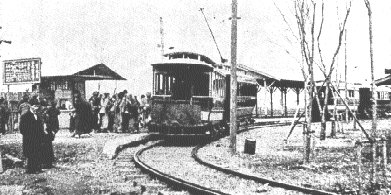
Two cars of the left are connected with the photograph assumed to have been taken a picture in the spring of 1901 though four cars fall on the loop-line, and the vehicle in the back seems to be being pulled by the accompanying car by the former electric motor coach. It is not possible to confirm it though it is thought that two cars of the right hand interior are also similar. It might be a guest of the cherry blossoms seeing of the saint river beach because it is spring. It is possible that the accompanying car is temporarily additionally connected if it is a loop-line, and the train is started one after another.
 Still, this loop-line mark clearly restricts the mark to the division of the Omori Station east exit. This loop-line mark has clearly come to the map where garrisoned circle prohibition district in the Omori Station east exit is shown. The upper side of the map becomes a Keikyu Omori-kaigan district.
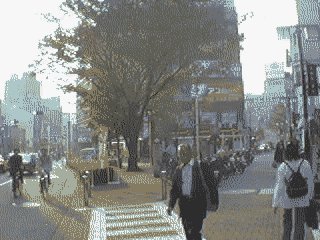
 A road in which it curves to forward and the left hand and a thin right road that goes straight are the orbit marks before.
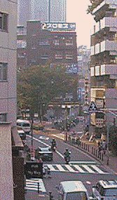
 Road where road curves to forward and left hand. It greatly curves to the right ahead of this.
 Things in the vicinity of Omori become tiles and it is set in the pavement on the road where Omori-kaigan Station is connected with JR Omori Station. There is a picture of the train that had run on this road in that before.
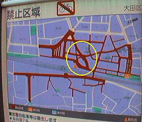
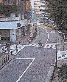
 The east exit of JR Omori Station and the vicinity of the point of the loop are the taxis of waiting for a customer and rows of an illegal garrisoned circle. The alley in the vicinity of the center of the screen is a place where the loop-line was returned. The building has been built at the position with the garage in the loop-line.
Big map