Very interesting news and material were offered from Mr. Mahboh..seeing my page. It was such a matter to have understood it was a start of a complex problem to throw a shadow out slightly as of it divided, and it was examined what situation "Anamori line" was immediately after the end of the war, too.
Here, I want to make it to the continuation one project of considering according to the gotten material, moving the section to "Forward planning" next, and advancing consideration further.
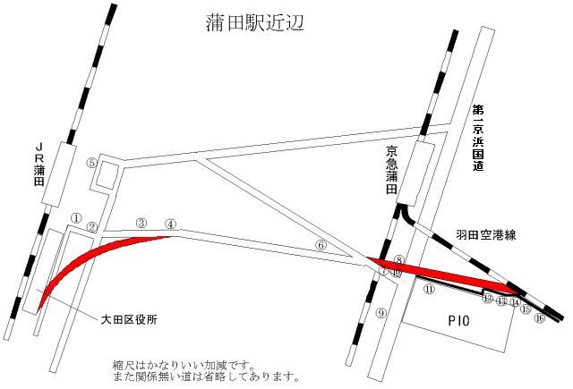
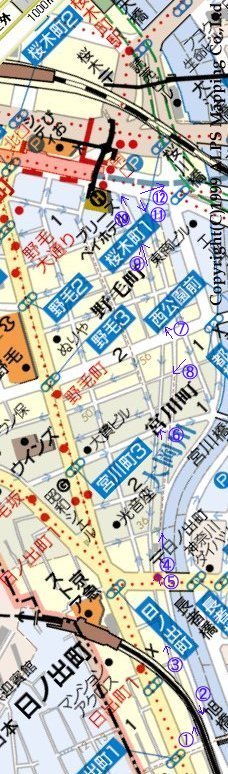
First of all, the description of the material that is reeled and gotten from Mr. Mahboh is selected and recorded leaving it as much as possible in the form of the state as it is. The map and photographs on this page to be making and taking a picture of Mr. Mahboh of all. When the photograph is clicked, the photograph of former size is displayed in another window. The number corresponds to the number in the map.
![]()
 Keihin Tohoku Line and Tokyu Ikegami Line and the Tamagawa line connect JR Kamata Station at the station located in the south end in Tokyo 23 district. Keihin Kyuko line on the other hand is made it to move to the east side at once, not to adhere to the JR line even of Yokohama as it is, and to draw close ..do not part.., runs, and exists from JR Kamata ..Keikyu-Kamata Station.. Station in the place where the degree parts at 10 minutes on foot though is in the west of the JR line only Shinagawa Station of the first train. The airport line that had been postponed here to the Haneda district was postponed in the Tokyo International Airport(Haneda) terminal recently, and the access became convenient.
It knew the aerophotograph of which the U.S. Air Force took a picture on the site of "Geographical Survey Institute" immediately after the end of the war recently and the photograph that the geography academy had taken recently had been opened to the public. There was the one that the vicinity of Kamata was taken in that, too and a mysterious thing was found there. There is a railway track where these two stations are connected.
This photograph is terrible.
Work name: USA10kKT and district: Kawasaki and course: M452-A and number: 68
Work name: USA10kKT and district: Kawasaki and course: M372 and number: 8
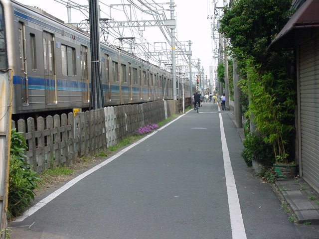
Anyway, please see. A considerably big yard is gained between Keihin Kamata and Japanese National Railways Kamata, and even the wagon that stops there can be seen. In addition, it is an image that the interest like the disused line mark etc. that cannot be missed by the Tokyu relation is not exhausted.
---Then, Mr. Mahboh was to see "Haneda Airport station mark" on this page of me and to have had knowledge about circumstances immediately after the end of the war reeling. ---
The same as the bus that continues from the 1st Keihin national road (the 15th in national road line) to the Kamata east exit very much when the railway track is applied to a geography today. And, the national road is placed between the photograph, there is a place like the accumulation place on the opposite side of Keikyu-Kamata Station, and be (It is facilities in the district now) there like the place with the fresh produce marts in old times. It went to the site and the photograph was taken though it was thought that there was little mark where it was left, too, when now came.
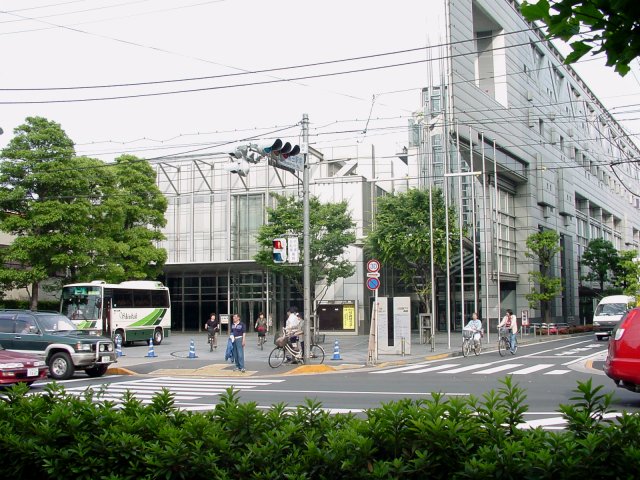
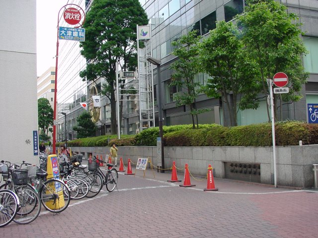 1: It is a place with the freight station in the old times though it is an Ota ward office now. It connects with nearby soon about here according to the bus.
 2: The place where the bus stops now is from an entrance to the exit here wanting the Keikyu-Kamata district the same as the bus, and the stop according to the bus only for getting off. It is a translation connected with the national road this ahead. By the way, it is a one-way road from the other side.
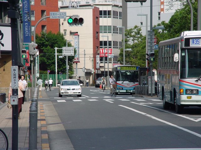 3: There is a slow curve in the vicinity to which it went from an intersection a little while ago where the Keikyu-Kamata district is wanted by about 100m from this side of the curve according to the bus. A railway track at that time might have arrived drawing the curve here larger and going side by side with conserved line (current JR line) Kamata Station if it saw from the aerophotograph.
 4: The Keikyu-Kamata district is wanted from a loose curve and it becomes straight really ahead of that. This might be the ideal at that time if it lays track because most will have been burnt ruins.
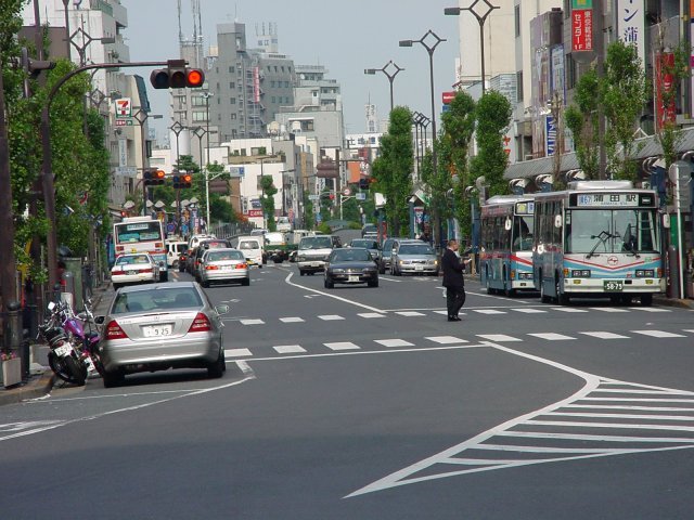 5: Here is wanting the Keikyu district from the Kamata Station front as shown in the starting place of the bus there. There is going on the way across the river, and the lash-up is done considerably. It is winding more as for the road excluding this. Because it doesn't seem to have opened the degree now, and the road that prints between fields and comes off develops and only it is sure to be done, be able Kamata at that time might be natural though was also the age with the film studio. It is more unnatural oppositely that a road a little while ago is too a straight line.
 6: The bus route bumps to the Keikyu line, two roads intersect immediately before there is a railroad crossing in the Keikyu line, and the road that came from the ward office side ends here. And, the store has been built in the other side of the railroad crossing and this road extension. It is interesting that the house in the road extension with is width of the road.
 7: Land sells and is not built in parallel to the road why like being diagonal though is the store. Are not you because this is because an old railway track intersects with a road here, and the land is sold like being diagonal of it?
 8: Row of the row of the house of the house in land of disposal there when extending well in the opponent and No.15 in the national road of the store. However, I think that the width says like a road really a little while ago.
 9: Ota industrial plaza (PIO) "Ota industrial plaza (PIO)" has been built in the mark that was the fresh produce mart in old times.
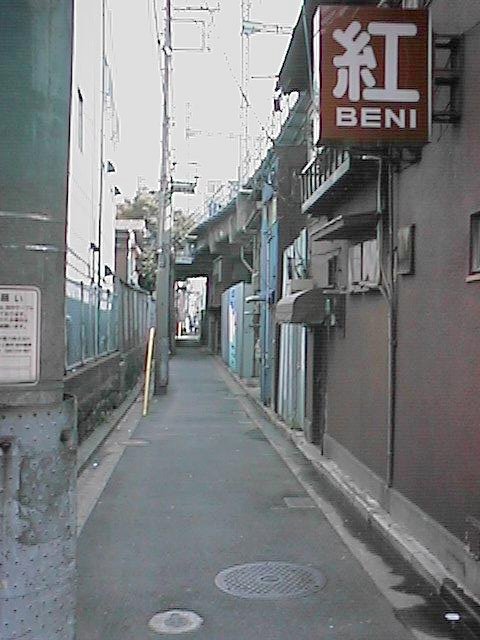
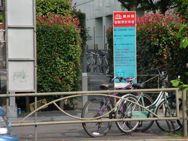 10: Ota industrial plaza (PIO) There is an alley that leads to bicycle-parking space when it sees between a row of the house in photograph 8 and industrial plaza of photograph 9 in Ota.
 Railway track..construct..bank..the..alley..policeman..reflect..place..site..sideward..along..for a moment..tree..grow thick..near..continue. The railway track might have been in the place where the other side and the house in the wall had built. The other side is from a part to rising more than here by 1 step, and feeling in the photograph even if it banks it when the railway track is really constructed though it is not understood that is the alley.
 12: And, the overhead wiring comes into view when going to bicycle-parking space.
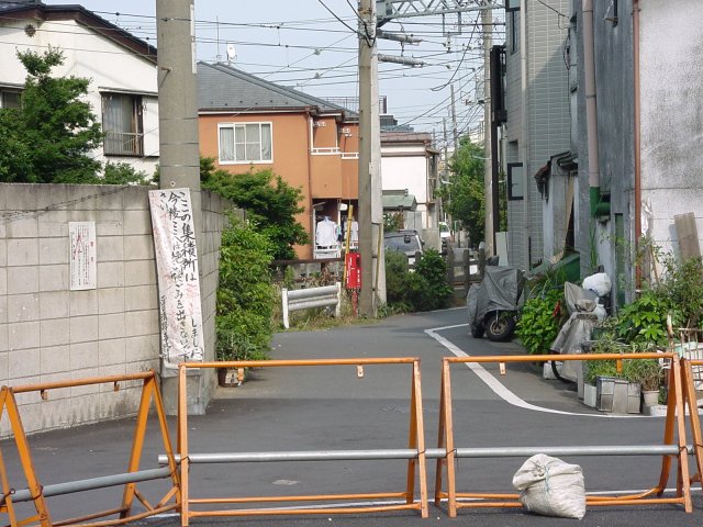 13: This alley is connected with the road the railway track sideward here.
 14: This photograph is taking of the alley of 13 from the opposite as for the site where a white building has built . This white building perhaps might ..site that had built.. have gone.
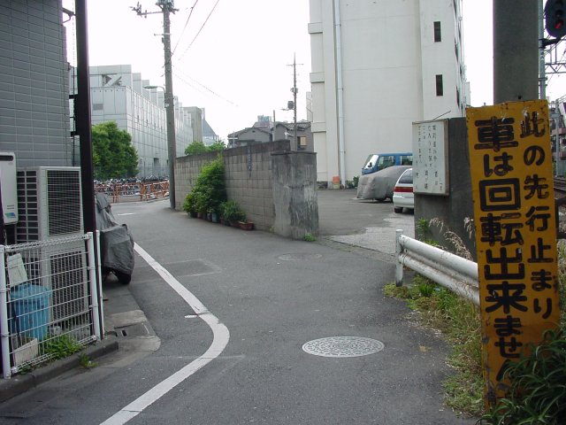
 15: It is a road along the airport line as for the site where a white building has built . It is unnatural that it suddenly leaves this vicinity only the national road side though it comes considerably from the other side for a long time following along the railway track when taking ones chance so. When the U.S. military took this each bypath, and it returned it, it is likely to have done with general land though it had connected in old times.
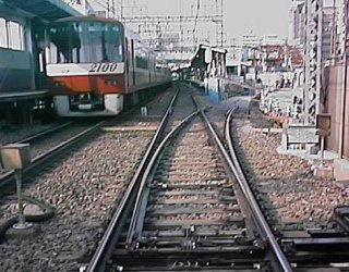
 16: Because the train had just passed each other in this vicinity, it took it though it was a superfluity for a moment that the train passed each other. I on the site was looking feeling admiration though it was likely to see in the photograph of passing each other without Cawatets either. In the line where it faces the airport from Keikyu-Kamata Station, even the vicinity in which a white building exists in photograph 14 is a single track. Therefore, the up train that goes to Kamata in this side until the down train that goes to the airport in the interior comes to the double-track line part doesn't advance it. Then, the point changes at once, and the up train advances slowly when thinking that the down train passed though it reduces speed once in the vicinity of the railroad crossing seen in photograph 15. I think that the blur person understands the speed of both is different. If making in the vicinity of Keikyu-Kamata to elevated to which this is advanced now advances, it is not possible do disappear and to know.
It is Mr. Mahboh's article above. crossing into the 15th national roads goes up once while the up train arrives after the down train starts from Kamata Station to tell the truth though it is a matter of passing each other of the train. The arrangement of the breaker sensor can be said it is strange with wiring seeming abnormally fast compared with another railway on the other hand the timing of the opening to traffic when the movement of the point in a single track section is seen though it is possible to think the interception time of crossing into is chopped like the purpose. crossing into the 15th national roads was the 1st moment kind, had the crossing into person, and the breaker was raised and lowered ahead by hand power.
Anyway, it must be a problem for the railway, and solidification is fixed gutter food way of the railway in the level crossing of this single track section and the national road for the road.
However, the ambush lurked here. It is a line of a basic plan concerning the maintenance of transport links that assume the new establishment of the short-circuited route the Keihin Electric Express Railway Co., Ltd. airport line and Tokyo Electric Express Railway, Ltd. Mekama line and center on the rapid-transit railway in the transportation policy council report No.18 and Tokyo metropolitan area January 27, 2000(report) taken up. Does this ground really dream a new line of the future though the disused line mark that reeled and Mr. Mahboh traced is a railway track mark where the compulsion accommodation was done so that the U.S.Army may maintain the Haneda airport?The item name of the above-mentioned report was compressed and title "Kama-kama short-circuit line" on this page was named without permission. The way of being of this "Unfinished line of the future"Kama-kama short-circuit line is a forward planning there It thinks in "The full of troubles future of Kama-Kama line".
(2002-07-12 edits)
(2003-12-25 reforms)
(2007-09-12 reforms)
 2: The Koganecho district is wanted from Hinodecho to the Ooka-gawa river. The train turns round the dogleg and it ..banks of a river.. cruises.
 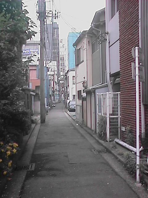 3: Curve of road from which elevated line deviated to the left. This example is work of imagining the railway structure that might be made from seeing the service road along a lot of "Disused line mark" that exists in the example or no "Unfinished line" it, and "Unfinished line". The map is for that, and it should be somewhere and there be accurate rapidity walking of me with the head. And, the railway structure that will be made will be vividly seen in the near future, and it is necessary to overlap with the building of the reality.
 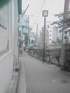 4: The Sakuragicho district is wanted from millionaire bridge west Ts that the Yokohama Ekinegishi road intersects with the Ooka-gawa river. There is a road after it descends once.
 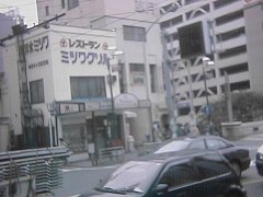 5: Site section along Yokohama Ekinegishi road. There is a bus stop in front of Hinodecho Station. "Mitsuwa grill" and the next building just correspond to the site mark. This width is 16 steps. It is unexpectedly narrow. It was 16 steps as which the elevated line of Keikyu under was the same.
 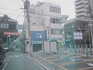 6: Five difference road in the Miyakawa-cho is wanted and the Sakuragicho district is wanted. Because the site in this side is a parking lot, the building of the site section is understood well. A snack and next building is width of the site. Be able my do listen to of the story of this site to managing the craft company in this vicinity. It is said that the owner was Japanese National Railways though this site was used according to it to lay track certainly. I hear that it borrows from Japanese National Railways and the site was open of the company though it was what was since prewar days. It is said that the site was used as leased land not the vacant lot etc. enclosed with the hedge but where.
 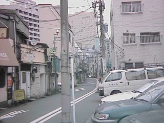 7: The Noge town wants the Sakuragicho district. It is a big building in the front. Station building in Sakuragicho. It slowly curves to the left and the tangent arc to Sakuragicho Station is drawn.
 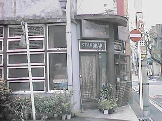 8: Bar in railway track site in Miyakawa-cho. The atmosphere of feeling of the 1955's remains as it is and it is good. It looks like the atmosphere of the place where I was born and grow up well and wherever you like around here in Yokohama. Eyes go to such a building inadvertently.
 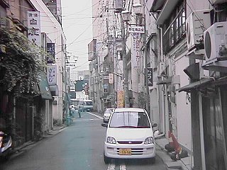 9: The direction that comes off from the Noge town to No.16 in the national road is hoped for. When a slow curve is extended, it connects with Sakuragicho Station. No.16 was wide, and the vicinity of Sakuragicho Station accomplished making to a whale of an by the redevelopment. The mark cannot be seen previously in the future.
 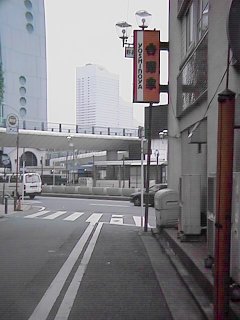 10: Position that comes off to No.16 in national road. There is a signboard of Yoshinoya.
 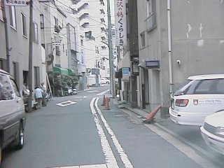 11: The Hinodecho district is wanted from the position that comes off to No.16 in the national road.
 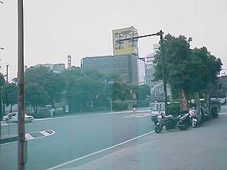 The direction of 16 in the national road is wanted from the same position as 12:11. Quite different though it is the same position view.
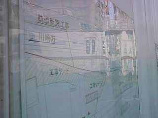 Plan chart posted at position of launching out into airport line. According to this, this diverges in the home and is connected with the Yokohama district descending line main line though crosses the first Keihin now and faces Tokyo International Airport(Haneda) by the airport line home (the first line).
 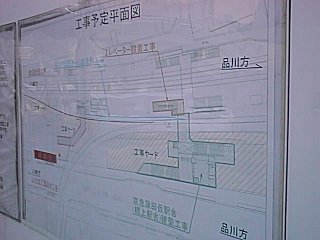 Plan chart. According to this, it seems to make the station on the bridge at the position where a present overbridge is extended. The stairs to this station might become the stairs at an elevated station of the future. Moreover, the stairs are made in the first Keihin measuring up, and the bus terminal is set up by station granting Kon. It might be a present construction yard that becomes a bus terminal.
 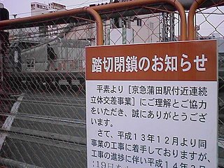 There were a small launching out into of touching in Umeyashiki at Kamata Station to the home in near. This was very a name of railroad crossing fifthly in Umeyashiki road. By what standard is the launching out into name applied?The railroad crossing has been closed by the home transfer according to the divergence construction from the airport line early.
 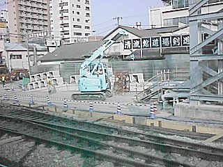 The construction of the road floor part is advanced in the bifurcation area from Yokohama. The tie in the point part integrates with the main line and is set up on the tip of and here.